The Babylonian World Map is believed to be humanity's first attempt at depicting the known world. Etched into clay tablets and estimated to date as far back as 600 BC, it depicts Babylon at the centre and Earth as a flat disc surrounded by ocean.
While popular thinking regarding the flatness of the Earth has since moved on, the desire for humans to make sense of the world around them has endured.
Fast forward to the present day and the impact of two millennia of human technological progress is plain to see. More than a billion people per month use Google Maps; the most popular smartphone app ever. Digitally enabled navigation is merely a pocket-sized integration into our everyday lives and perhaps the most taken-for-granted innovation of all time.
Yet, there remain frontiers where digital navigation solutions are only starting to gain a foothold. If an ancient Babylonian were handed a smartphone and taught how to use Google Maps, they'd be forgiven for assuming that the navigation experience would seamlessly persist inside buildings.
However, the majority of indoor solutions struggle to match the effortlessness of our favourite outdoor-focused apps - but why?
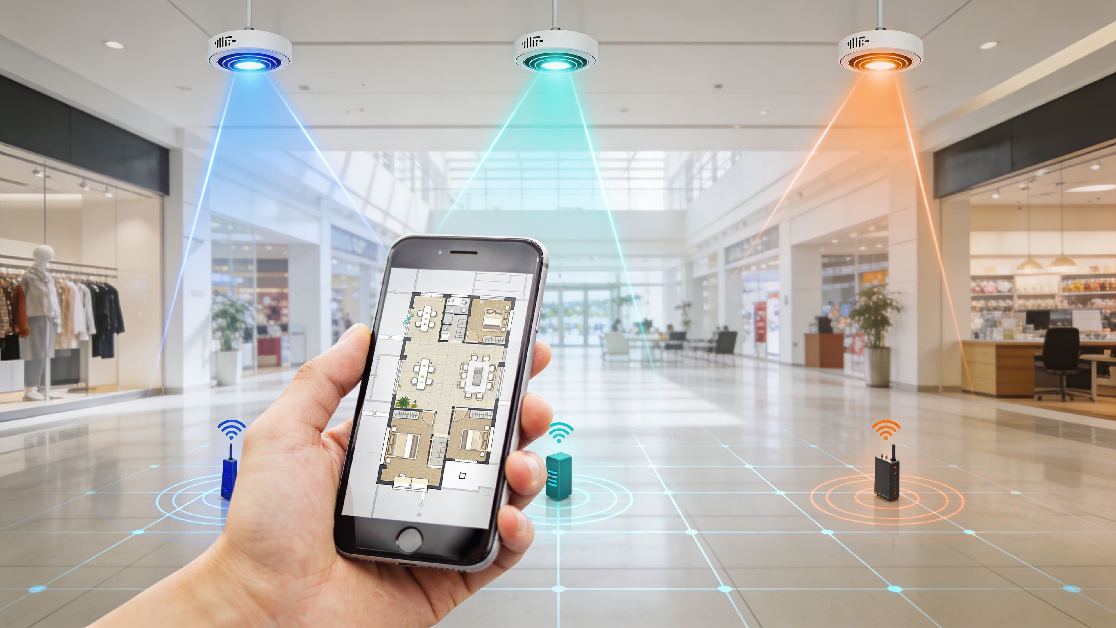
Indoor positioning without GPS
Indoor positioning technology fundamentally differs from outdoor, for the simple reason that GPS coverage is strongly affected by physical obstructions such as a roof.
Multiple emergent technologies exist to deliver indoor positioning, however, most rely on a great quantity of wall-mounted hardware combined with the technology present in our smartphones. Bluetooth Low Energy (BLE), WiFi, and Ultra Wideband (UWB) are just a few examples.
No single technology commands the market as each comes with its pros and cons. Accuracy, reliability, cost, hardware interoperability, and maintenance are just a few of the factors that must be balanced to deliver a seamless experience.
User experience in a complex, indoor space
Digital representations of outdoor spaces are easily comprehensible by humans because they are usually rendered in a two-dimensional top-down view. Users can compare the map with the real-life visible landmarks they can see around them which greatly helps in figuring out position.
A multi-storey, complex indoor space not only introduces an additional dimension but usually includes corridors and rooms. Solid walls make the visibility of landmarks non-existent, leading to an often bewildering user experience.
What can be done?
Utilising multi-technology models
The key to optimising indoor positioning data is to not be limited to a single technology to provide position data. Modern smartphones can leverage BLE, geomagnetic, WiFi, accelerometers, GPS, and UWB, a mathematical model capable of leveraging a selection of these technologies in tandem to better provide accurate positioning across a range of difficult scenarios.
Providing strong UX and multi-dimensional maps
The optimal UX for indoor navigation is tricky to define.
Many companies are experimenting with cutting-edge features such as detailed 3D map visualisations, augmented reality, haptic feedback, and 'floor switcher' features. Putting aside the eye-catching innovations, the number one question that indoor solutions must answer is “Can my audience get what they need from this map?”.
It's easy to forget that AR has been available in Google Maps since 2019 and has gained little to no traction as a method of navigation. The latest 3D maps are works of art and highly accurate, but research shows that in many cases 2D is easier for humans to process.
In UX, Jakob's Law states that “users spend most of their time on other sites. This means that users prefer your site to work the same way as all other sites they already know”.
Google Maps has been around since 2005, which means users have been building familiarity with its mapping interface and gestures for almost 20 years. This is not to say that there is no scope for innovation with indoor solutions, but rather that departures from its standard UX should be carefully considered, deliberate, and rigorously tested.
See how Purple delivers outstanding mapping and indoor navigation for some of the world's most recognisable brands with Digital Wayfinding .
For further reading on the fascinating subject of human comprehension of 2D vs 3D maps check out the following:
People are not frogs written by web usability legend Jakub Neilsen
To 3D or not to 3D written by Mark Harrower