What is Indoor Mapping and Wayfinding?

Indoor mapping and wayfinding help users find their way through indoor settings like malls, airports, hospitals, and large office buildings. They digitally create indoor spaces to provide detailed maps and real-time navigation. They tend to improve user experience, enhance operational efficiency, and increase engagement within physical venues.
Core Technologies
Indoor mapping and wayfinding rely on several core technologies:
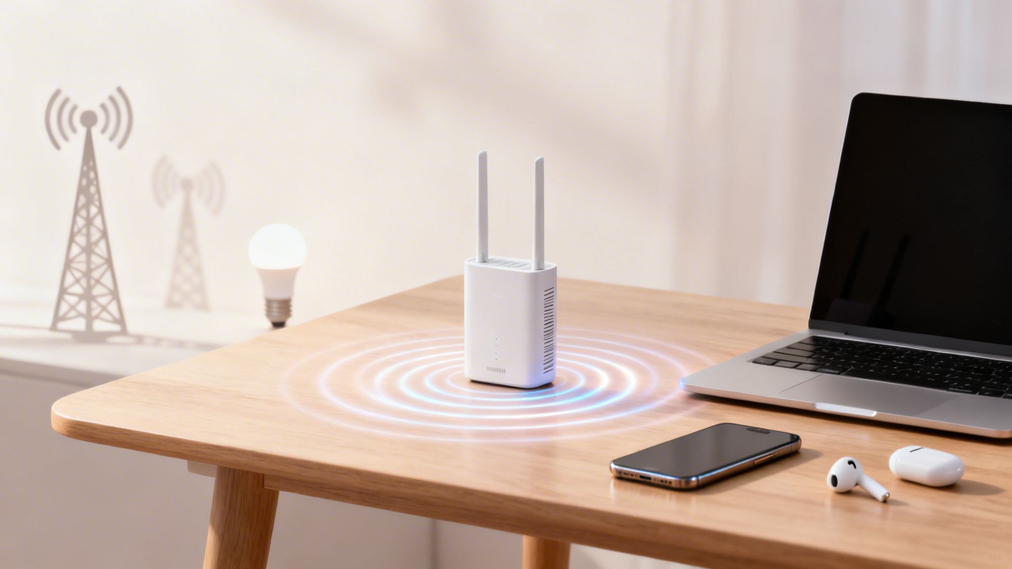
- WiFi: Mapping technology can use WiFi to pinpoint a user's location inside a building. It's cost-effective since most venues already have WiFi.
- Bluetooth Beacons: Indoor mapping and wayfinding can use Bluetooth to help pinpoint the location of workers or equipment. These are generally high-accuracy solutions.
- RFID (Radio Frequency Identification): Mapping technology leveraging this can track equipment and people using radio waves. They are commonly used in asset tracking and inventory management.
- Infrared Sensors: RTLS systems can leverage this to detect movement and can be used with other technologies to improve tracking.
- Augmented Reality (AR): This technology creates indoor maps that can guide users with visual cues on their phones.
Wayfinding Tech
Wayfinding technology includes:
- Mobile Apps: Offer interactive navigation and maps, which can improve user engagement at the venue.
- Kiosks and Digital Signage: Provide static and/or interactive maps at critical locations to help users with directions.
- QR Codes and NFC Tags: Enable quick access to maps and navigation by scanning with a smartphone.
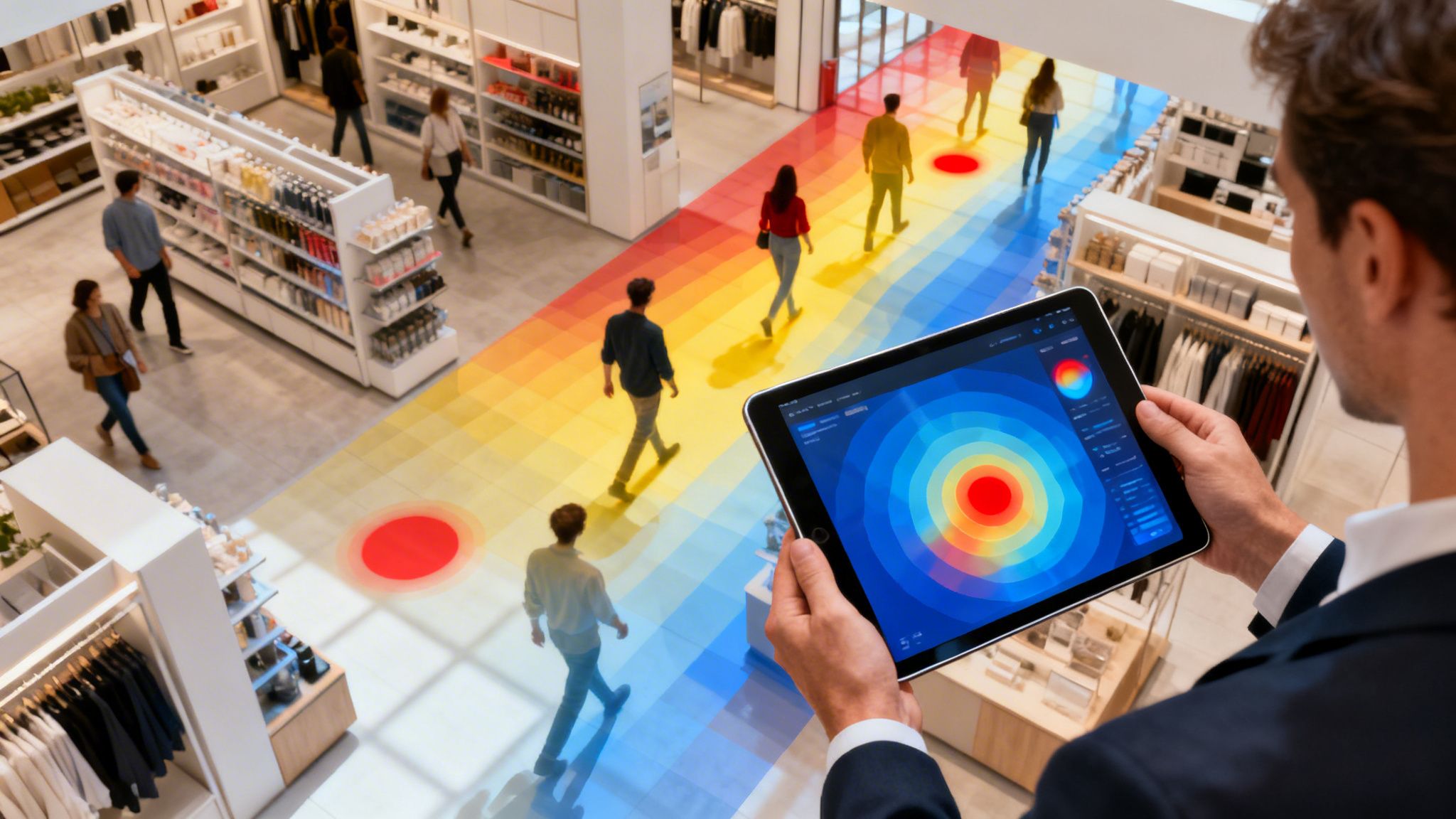
- Data Analytics: Collect and analyze user movement data to help businesses optimize layouts and improve service.
These technologies work together to create better indoor navigation experiences that benefit users and businesses.
Top Uses of Indoor Navigation Apps and Software
Indoor navigation software shows how businesses and users interact within large venues. Here are the top uses:
- Customer Experience: Increase satisfaction by providing navigation in complex spaces. Guests can quickly locate stores, restrooms, exits, and other amenities.
- Operational Efficiency: Streamline operations by tracking staff, assets, and inventory, which improve resource management and operational costs.
- Marketing and Engagement: Send targeted promotions and notifications that can increase sales and visitor engagement.
- Accessibility: Enhance accessibility for all users and those with disabilities.
- Security: Improve safety and security by enabling evacuation plans and tracking during emergencies.
Complex Spaces Like Malls, Hospitals, Airports, and More
Indoor navigation is particularly beneficial in complex spaces such as:
- Malls: Help shoppers find stores, restaurants, and services quickly. Increase foot traffic and sales with location-based promotions.
- Hospitals: Help patients and visitors navigate to departments, clinics, and patient rooms.
- Airports: Guide travelers to gates, baggage claims, and other amenities.
- Universities and Campuses: Aid students and visitors in finding classrooms, libraries, and event locations.
- Convention Centers: Help attendees locate booths, conference rooms, and services.
Sports Stadiums and Arenas
With large and complex layouts paired with high visitor volume, implementing wayfinding technology at sports stadiums and arenas can improve visitor experience and operational efficiency.
Visitor Experience
- Navigation: Indoor mapping and wayfinding apps help visitors find seats, restrooms, concessions, and exits in real time. Some apps also offer congestion reports and turn-by-turn directions to ensure guests can reach their location quickly.
- Event-Specific Information: Customization allows planners to guide guests to specific entry points, VIP areas, or merchandise stands based on the event happening at that time.
Operations
- Crowd Management: Visitor tracking and movement can help operators manage crowds and reduce congestion to improve safety. During emergencies, these systems can guide visitors to designated exits quickly and efficiently.
- Staff Coordination: Indoor mapping can help operators coordinate and disperse staff to areas where support is needed
- Asset Tracking: Managing and tracking equipment, maintenance tools, and merchandise within the venue helps reduce loss and improves inventory management.
FAQs: Everything You Wanted to Know About Indoor Mapping
Why is indoor mapping important? It enhances user experience, operational efficiency, and engagement by providing directional insights to users.
How accurate is indoor mapping? Accuracy depends on the technology used. Read more about different technologies here [BLOG CTA]
What are the costs associated with indoor mapping? Costs vary based on the venue's size, the mapping's complexity, and the technologies used. Initial setup, hardware (like beacons), and software licenses are typical expenses.
Can indoor maps be integrated with existing systems? Indoor maps can be integrated with CRM, inventory management, and other enterprise systems for a comprehensive solution.
Indoor Mapping vs. Outdoor Mapping
Indoor mapping and outdoor mapping serve different purposes and use distinct technologies:
- Technologies Used:
- Indoor: WiFi, Bluetooth beacons, RFID, infrared sensors, magnetic positioning, and augmented reality.
- Outdoor: GPS, satellite imagery, and cellular triangulation.
- Accuracy:
- Indoor: Offers high accuracy within confined spaces, often down to a few meters.
- Outdoor: Generally accurate within a few meters, suitable for larger geographic areas.
- Applications:
- Indoor: Malls, hospitals, airports, office buildings, and event venues.
- Outdoor: Road navigation, location-based services, and geographic information systems (GIS).
How to Get Started
To get started with indoor mapping and navigation:
- Assess Your Needs: Determine the goals and requirements for your indoor navigation system.
- Choose the Right Technology: Select technologies that fit your venue's needs and budget.
- Create Detailed Maps: Use mapping software to develop accurate indoor maps.
- Install Hardware: Deploy necessary hardware like beacons or sensors.
- Integrate with Existing Systems: Ensure the indoor mapping solution integrates with your current systems.
- Test and Optimize: Conduct thorough testing to ensure accuracy and user-friendliness. Gather feedback and make necessary adjustments.
- Launch and Promote: Roll out the system to users and promote its benefits.