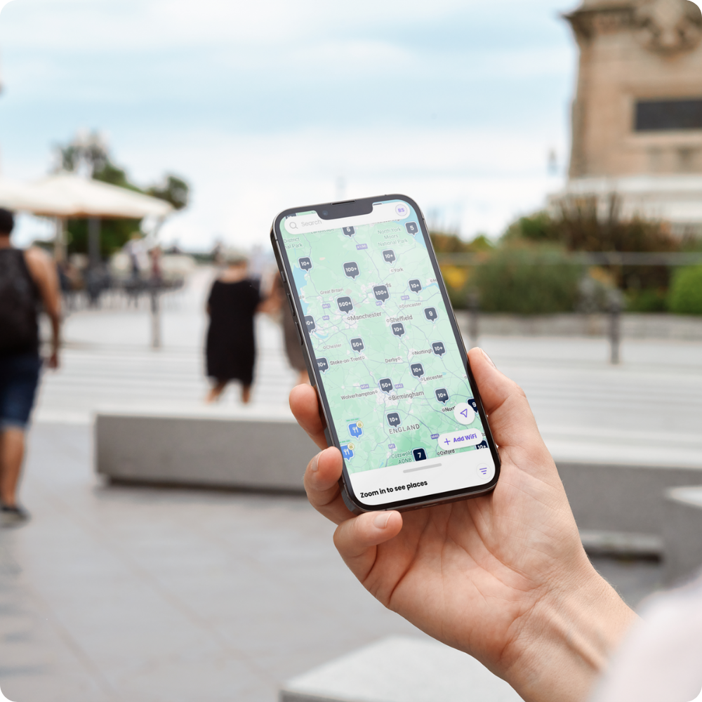
Guest WiFi that's secure, seamless, and everywhere.
Imagine a world where Guest WiFi security is guaranteed, compliance is a given, customer connectivity is seamless, and data sharing is easy.
Using Identity-Based Networks, your WiFi delivers what users need: a secure, seamless experience that drives ROI and improves customer experiences. That's the power of Purple.

Loved by venues globally


.svg.avif)


Guest WiFi that's got it all ✨
Security, compliance, and seamless connectivity? Our Guest WiFi locks them all down. 🔒 Plus, with powerful plans for clean customer data capture, it's the ultimate high-five between IT, Marketing, and ROI.
- ISO-certified solutions for IT
- Clean contact lists for Marketing
- Seamless connectivity for customers
- Proven ROI for businesses

Security locked down🔒
Don't let connectivity cause you headaches. Embrace complete peace of mind with enterprise-grade protection, secured with WPA2/3 Enterprise encryption and globally compliant Guest WiFi solutions your whole team can depend on.
- 99% uptime
- ISO-certified
- Overlay onto existing hardware
- Network health analytics

Valuable insights unlocked 🔓
Stop chasing bad leads, and start enriching your CRM with conscious-choice opt-ins. Gain clean, compliant, and high-intent contact lists to maximize your marketing efforts and slash acquisition costs.
- GDPR and CCPA compliant
- High-intent database
- CRM integration
- Powerful analytics

Small business ready ✨
Searching for suitable small business Guest WiFi solutions? We've got you covered. From our powerful plug-and-play Hub to Marketing Essentials, our solutions are designed with your needs in mind.
- Secure and compliant
- Seamless for customers
- Built for small businesses
- Get started for free

Always secure 🔒
Unsecure public networks? Not here. We're so serious about security, we're ISO-certified. And liability? We've got it locked down with data minimization. No more worrying about data breaches, violations, or hefty fines. Just peace of mind knowing our identity-based networks offer you a compliant, cloud-based Guest WiFi.
- Certified secure
- Data compliant
- 99.99% uptime
- Unique session keys to prevent network sniffing
- Scalable solutions

Incredibly seamless ✨
Our captive portals are the best. But visitors? They're still frustrated by forms. It's why we've removed the friction with the Purple app: combining seamless connectivity with conscious opt-ins in a single app. It means leads are no longer a click for free WiFi — they're high-intent contacts Marketing can count on.
- Easy data sharing
- Clean database
- Powerful analytics
- CRM integration
- Personalization
Enjoyed globally 🌍
We make it easy to turn poor WiFi into maximum value across all your venues with scalable, secure, and seamless Guest WiFi. But our purpose doesn't stop at great technology. Join a global unified network of over 80,000 venues making connectivity digitally inclusive, everywhere.
- Proven business ROI
- Global unified network
- OpenRoaming enabled
- The Purple app
- Seamless connectivity
- Digital inclusivity
Designed for everyday connectivity
Secure and seamless connections are no longer a nice-to-have; they're a must-have. That's why our Guest WiFi delivers exceptional experiences, everywhere.

Home
Provide online security where it matters most with Guest WiFi for hotels, student accommodation, and more.
- Resident guest access
- Secure visitor networks
- Scalable solutions

Work
Offer stable connectivity and seamless profile-based access with Guest WiFi for offices, campuses, coworking, and more.
- Visitor network isolation
- Enterprise compliance
- 99.99% uptime

Play
Enhance customer experience across all types of play with Guest WiFi for attractions, travel, retail, hospitality, and more.
- Customer data capture
- Marketing automation
- Intelligent rewards
Get to know your customers better
Stop guessing what drives performance. Empower your business to truly understand its customers and physical spaces with powerful website-level analytics. Dive deep into demographics, behaviors, and return rates, compare venue performance across your estate, and turn insight into immediate opportunity.
- Identify repeat visit trends to fuel loyalty
- Build digital profiles with CRM integration
- Analyze footfall to optimize operations
.png)
90% reduction in the need for IT engineers
Learn how McDonald's leveraged our secure Guest WiFi solution and its powerful analytics to reduce the number of physical site visitors from IT engineers by 90%.
Explore more Guest WiFi features
Get ready for Guest WiFi
Discover a range of helpful resources and information to help you get started with Guest WiFi, from technical implementation to useful integrations.
Reimagine your Guest WiFi potential with Purple
Unlock a world of new opportunities with Guest WiFi. Speak to an expert to get started today.


.png)


.png)


