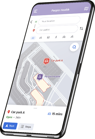
Real time digital wayfinding to navigate the indoors just like the outdoors
Improve your visitors’ experience, safety and accessibility with blue-dot navigation, web-based maps, route planning and location alerts.
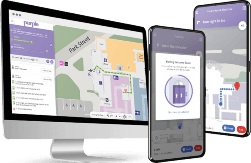


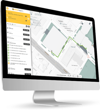
How our digital wayfinding works
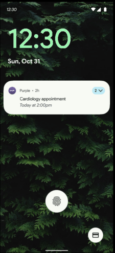
Appointment or meeting reminder
Accessibility routes

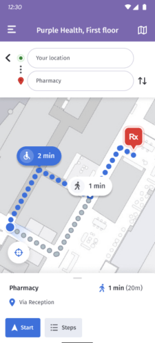
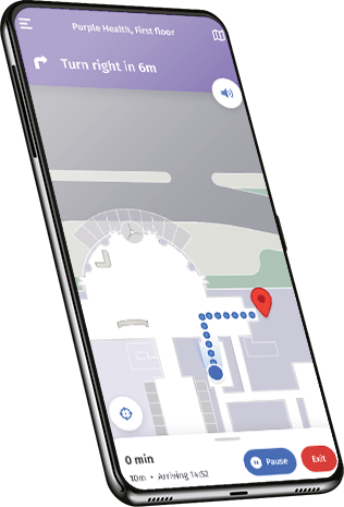
Turn-by-turn routes
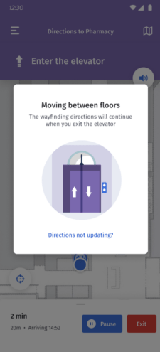
Seamless navigation
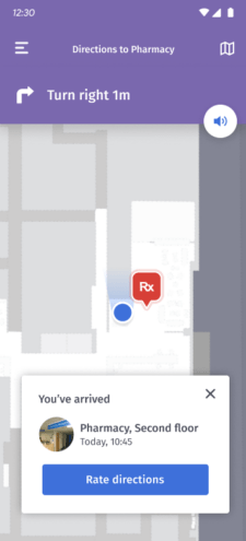
Arrival at destination
Appointment or meeting reminder
Accessibility routes
Turn-by-turn routes
Seamless navigation
Arrival at destination

Enable visitors to get where they need to be
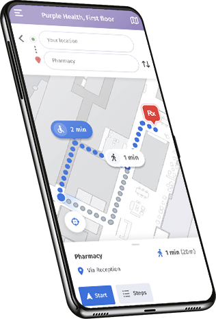
Provide the best route for those with accessibility needs
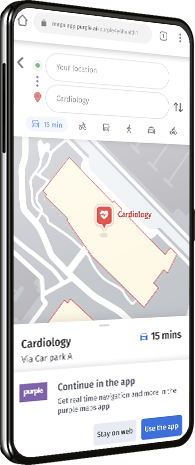
Navigate from off-site to a specific room in your venue
Increase staff productivity and efficiency
Maximize your wayfinding budget with our geomagnetic technology
Wayfinding involves guiding people from one location to another using traditional maps, signs, and landmarks. Digital wayfinding enhances this process by utilizing technology such as smartphones and interactive kiosks, providing dynamic maps and step-by-step directions.
Real-Time Location Services (RTLS) are advanced technologies used to track assets, people, or equipment in real-time within a defined area, enhancing operational efficiency and asset management in various industries.
The blue dots on your navigation indicate your real-time location on a map, enabling effective navigation using GPS technology. This helpful feature is commonly found in navigation apps and maps for easy wayfinding.
RTLS stands for Real-Time Location Services.
A wayfinding system is a collection of visual cues, signs, and digital elements such as interactive displays and mobile apps, designed to guide people through a specific environment efficiently.
Digital wayfinding is a technology-driven navigation system that uses interactive maps, touchscreens, and mobile apps to assist people in finding their way in complex indoor and outdoor spaces.